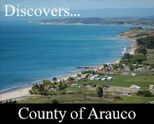
This city is located to 91 Kilometers of Arauco, its you limit they are for the north Arauco; to the southeast The Poplars; to the east, Curanilahue, and to the west, the Ocean Pacific. It has an extension of 562,9 Km2 of surface and 25.035 inhabitants.
The commune of Lebu, provincial capital, has diverse attractions of tourist character, in its majority related with the mining activity, the coast and the marine gastronomy.
The most important economic activity until a couple of years ago it was the extraction of the black mineral that goes back by the middle of the XIX century, initiative developed then in those by Matías Rioseco Rivera and that later it would be renewed by Maximiliano Errázuriz and José Torres Urmeneta; at the present time, the company is low the administration of the National Company of the Coal CORP. (Enacar). Today in day Lebu has ended up becoming one of the main ports of handmade fishing of the country, ending up providing around 30% in the capture, to regional scale.


